Call Or Email
(770) 569-1111
Click to Email

Ground Penetrating RADAR / GPR Georgia

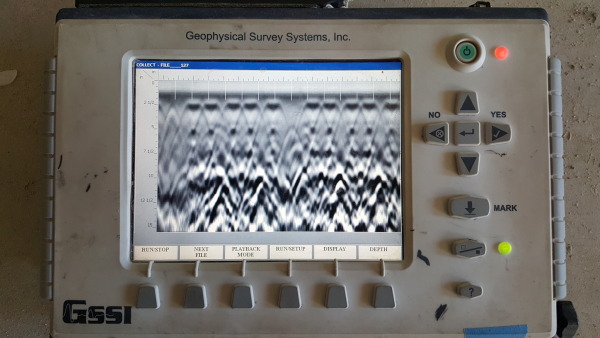
Ground Penetrating RADAR or GPR is a geophysical method that has been used for subsurface exploration for over 35 years. GPR can typically be performed using various techniques from Satellites to surface scans. Until recently GPR was typically used to map subsoil properties, water tables, and location of subsurface objects.

Read 2113 times

Leave a comment

Make sure you enter all the required information, indicated by an asterisk (*). HTML code is not allowed.

 Ground Penetrating Radar - Archaeology - GPR - GPR Concrete Scanning - Geophysical Survey - Structural Analysis  - gpr concrete scanning

NORTH CAROLINA
Charlotte city Raleigh city Greensboro city Winston-Salem city Durham city Fayetteville city Cary town Wilmington city High Point city Greenville city Asheville city

SOUTH CAROLINA
Charleston Columbia North Charleston Mount Pleasant Rock Hill Greenville Summerville Goose Creek Sumter Hilton Head Island Spartanburg Florence Myrtle

TENNESSEE
Nashville-Davidson Memphis Knoxville Chattanooga Clarksville Murfreesboro Franklin Jackson Johnson City Bartlett Hendersonville Kingsport Smyrna Collierville Cleveland


GEORGIA
Atlanta Augusta-Richmond County Columbus Macon-Bibb County Savannah Athens-Clarke County Sandy Springs Roswell Johns Creek Warner Robins Albany Alpharetta

ALABAMA
Birmingham Montgomery Huntsville Mobile Tuscaloosa Hoover Dothan Auburn Decatur Madison Florence Phenix City Prattville Gadsden Vestavia Hills Alabaster 

 Ground Penetrating Radar - Archaeology - GPR - GPR Concrete Scanning - Geophysical Survey - Structural Analysis  - GPR Concrete Scanning
© Copyright 2019, Baldwin RADAR Imaging llc. All Rights Reserved

Cron Job Starts