Blog (61)
Like all things in the Charlotte, North Carolina market the GPR scanning
market is seeing massive growth as well. Many more building managers and owners are requiring it. This is due to three main factors. The reduced risk of damage done to structural elements like that of PT cable. The increased safety of those who are cutting, coring, or drilling by avoiding electrical conduit. The quality of the experience for the clients, no one wants to lose power to their office for a week due to the remodel going on one floor above. Because of these things stacked alongside the overall growth of the commercial market we have seen a significant increase in inquires for GPR from the Charlotte, North Carolina region.
Concrete scanning of an elevated slab leaves a very clear image for GPR as we can see the bottom of the slab and everything in between. The only thing we can not see doing concrete scanning is directly under steel like rebar. This is why we recommend on all concrete scanning jobs to not drill, cut, or core on our lines. If a conduit is directly under rebar our system would not be able to detect it. However the clear space between our lines are 100% risk free and guaranteed by us as safe to drill, cut, or core.
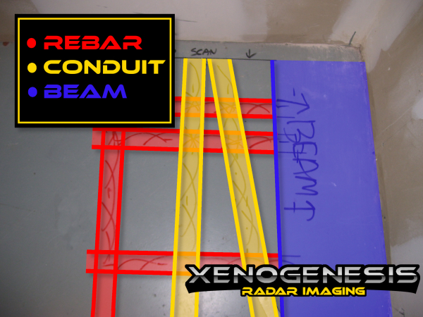
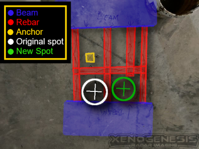
Our Goal at Xenogenesis RADAR is to help you hit nothing but concrete. We try to help our customers avoid all Rebar, Conduits, PT, Beams, and Anchors. Some times there just is no clear location and moving the hole over a foot in another direction is not an option. In these cases, we try to help you pick the safest option available. In the picture above there was not a good option to avoid all contents of the concrete slab, so the technician would choose the clearest example of rebar and make a recommendation of where to core.
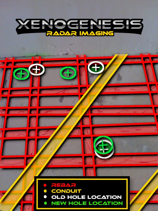
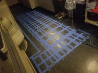
This Ground Penetrating RADAR (GPR) Scan was for a floor box. The area was scanned and the box was able to be relocated to avoid any damages to the surrounding conduits. This saved alot of money and headache for the client as well as being much safer for the coring company that would of been coring the hole.
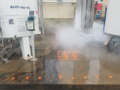
This outdoor Slab on grade job took an unusual turn. The slab was about 20 feet by 30 feet. We needed to locate the depth of the slab and if there was rebar and if so the spacing. This patio slab held two storage tanks. My guess would have been 6 to 8 inches and wire mesh. So we took out the 2600 Mhz rig and start rolling and can't see the bottom of the slab, so we moved to a 1600 Mhz, 900mhz and then finally on the 400 Mhz antenna we found the bottom of this small slab on grade area at over 3 feet deep and rebar 1 foot on center 15 inches deep. This is deeper than footers I have seen in large hospital buildings. My guess for each tank would be somewhere between 4 to 6 tones. My guess for the strength of the concrete slab supporting them 13,500 to 27,000 tones. So to the question at hand, will it hold the added weight of a new tank? It should do an ok job at supporting the weight for the next 100,000 years or so.
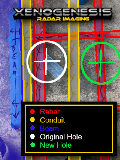
Ground Penetrating RADAR (GPR) can locate voids or anchors in concrete slabs. By mapping out the rebar mat and scanning the areas in between you can identify any anchors that may be present. GPR can also get an accurate thickness of the slab. Because of this concrete beams can easily be located and avoided.
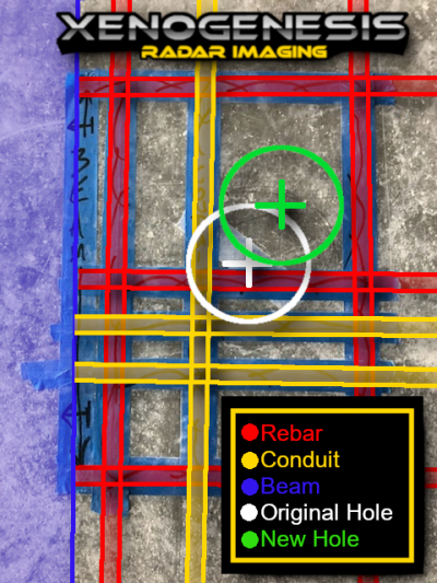
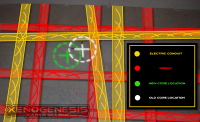
In this scan location, we found a high concentration of electrical conduits. The original location of the core was going to pass through two electrical conduits embedded in the slab. This was simple to avoid by moving the location 3 inches to an area clear of any steel or conduits. Call before you dig, and scan before you core.
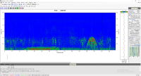
GPR Viewer from www.gpr-archaeology.com is one of the best tools for viewing GPR data. This is a FREE tool made by Lawrence B. Conyers. When compared with options like RADAN 7 offered by GSSI it may be lacking features, but when you are talking free vs $4000 per computer it's an amazing solution. I have used GprViewer many times for large and small projects even on occasion over RADAN 7 of with we have a full copy. When I am having issues interpreting the data I am looking at throwing some passes in GprViewer and taking a better look has saved me more than a few times. One of my personal favorite features is how it handles gain. You can vary the gain at different depths and get a clearer picture of what is going on. I would love to see this ported to Android or IOS for use on a tablet, but being as this is a free program that would be a value option at several hundred dollars you really can't complain.
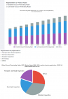
The ground penetrating radar (GPR) market is expected to grow from USD 493 million by 2019 to USD 726 million by 2024 at a CAGR of 8.1% from 2019 to 2024
Safety concerns and the protection of underground utilities are a large segment of the growing market, as well as evaluating aging infrastructures such as highways and bridges. The advantages of GPR over other traditional destructive technologies such as taking core samples, and government support for the implementation of GPR are among the key factors driving the market growth.
Although Europe is representing 50% of the total GPR market it is expected that the US market will be catching up as more high-value lines such as fiber become more prevalent.
Ground Penetrating RADAR will save you money and keep your team safer. We find one in five scan locations are located above a conduit, PT cable or another significant object. The price of hitting one conduit or PT cable would cost more than 30 scans on average to repair. Xenogenesis offers a guarantee on all elevated slab scans. If we miss it we cover the cost. This means when you hire Xenogenesis your budget is safe from damages related to coreing and saw cutting on all elevated slab work. Why risk your team's safety to luck when it comes to coring into a conduit, when you can avoid it altogether.
More...
GPR 3D Imaging is a useful tool for getting a picture of what is in the subsurface. Although not often needed in day to day GPR scanning applications it is a useful tool for engineers when more information about the subsurface is required. For getting a better look when coring on rebar is the only option, you can also analyze the area in 3d, and double-check no conduit or PT cable is running parallel. 3D is also available for utility or other grade applications for those who needed the data for geophysical applications.
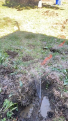
Water can drastically affect the attenuation of the GPR signal in soil and in large concentrations will outright block the signal. This means in areas of wet clay the depth might be limited to as low as 4 feet but in very dry sandy conditions may reach as low as 12 feet. This property can make water leaks very easy to locate with GRP. If you are having trouble locating the source of your massive water bill having a GPR tech come out might be your best option.
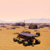
The China National Space Administration’s (CNSA) is going to use Ground Penetrating RADAR to look at the subsurface of Mars. The CNSA has not yet sent an orbiter to Mars but plans on skipping this step to look at the surface and subsurface faster. The rover is aimed to launch sometime in the summer and should arrive in 2021. This type of Ground Penetrating RADAR (GPR) is also going to be in the NASA Mars 2020 rover, due to launch in July. The combination of subsurface information from multiple sites and both rovers will boost our knowledge of how Mars was formed. Abundant ice is present beneath the permanent carbon dioxide ice cap at the Martian south pole and maybe in the shallow subsurface at more temperate conditions. If the GPR can locate a shallow reign on Mar's water table this would go along way towards making a colony on Mars possible.
Top Market Performers
GSSI
MALA
IDS GeoRadar
GEOTECH
SSI
US Radar
Utsi Electronics
Chemring Group
Radiodetection
Japan Radio Co
ChinaGPR
Kedian Reed
Another steady growth year for GPR. We are very happy to be part of such an important industry.
Full report https://analyticsp.com/2020/01/03/recent-report-on-ground-penetrating-radar-gpr-market-2019-transport-and-road-inspection-municipal-inspection-disaster-inspection-archeology-others/
Ground Penetrating Radar - Archaeology - GPR - GPR Concrete Scanning - Geophysical Survey - Structural Analysis - GPR Concrete Scanning
